


As a provider of Infrastructure Models, I understand the significance of usability in these models. Infrastructure models serve as crucial tools for various stakeholders, including architects, urban planners, developers, and investors. They help in visualizing complex infrastructure projects, making informed decisions, and communicating ideas effectively. In this blog post, I will discuss several ways to improve the usability of infrastructure models.
1. Enhance Real - world Representation
One of the primary ways to improve the usability of infrastructure models is to make them as realistic as possible. A high - fidelity model that closely mimics the real - world scenario provides users with a better understanding of the project.

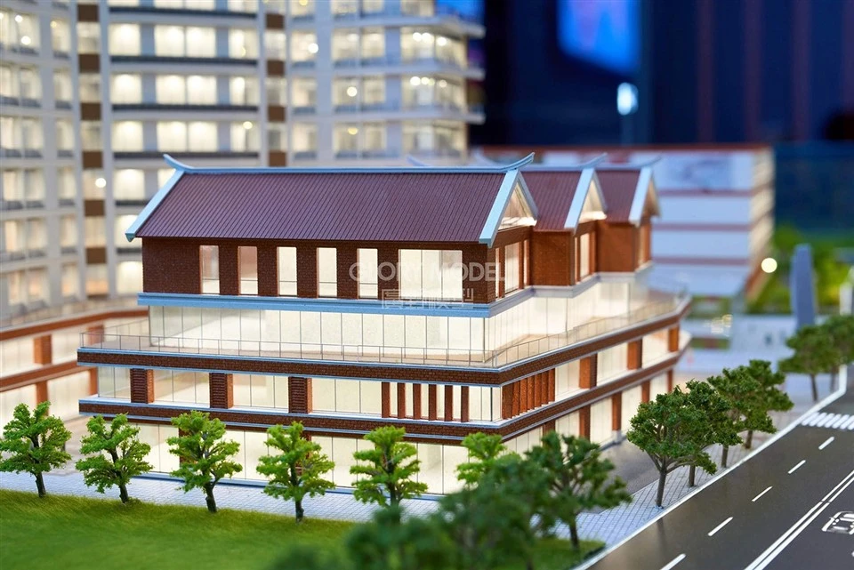
- Accurate Geometry and Scale: Ensure that the model has accurate geometric shapes and is built to the correct scale. This allows users to accurately assess the size and proportion of different elements within the infrastructure. For example, in a Crystal Architectural Models, precise measurement of building facades, windows, and doors gives a true sense of the structure's size and spatial relationships.
- Textures and Materials: Incorporate realistic textures and materials into the model. Different materials have distinct visual and tactile properties. Using appropriate textures for roads (e.g., asphalt or concrete), buildings (e.g., glass, brick, or steel), and landscaping (e.g., grass, trees) can greatly enhance the model's realism. For instance, in Industrial Park Models, the use of accurate metal textures for factories and industrial equipment makes the model more believable.
- Environmental Elements: Add environmental elements such as weather conditions, lighting, and natural surroundings. Different lighting conditions can have a significant impact on how the infrastructure is perceived. For example, simulating sunlight at different times of the day can show the shadow patterns and highlight the building's features. In Theme Park Models, adding elements like artificial lakes, gardens, and sky can create a more immersive experience.
2. Provide Interactive Features
Interactive features make infrastructure models more engaging and useful. They allow users to explore the model from different perspectives and gain in - depth information.
- 360 - Degree Viewing: Implement a 360 - degree viewing option, which enables users to rotate the model in all directions. This feature is particularly useful for getting a comprehensive view of large - scale infrastructure projects. For example, in an urban infrastructure model, users can spin the model to examine different neighborhoods, transportation networks, and public spaces.
- Zooming and Panning: Offer zooming and panning capabilities so that users can focus on specific details or areas of interest. In a complex infrastructure model, such as a large - scale transportation hub, users can zoom in to see the layout of platforms, ticket counters, and waiting areas.
- Hotspots and Information Pop - ups: Place hotspots on the model to provide additional information. When users click on a hotspot, a pop - up window can appear with details about the corresponding element, such as its function, capacity, or construction materials. For example, in a power plant model, clicking on a turbine can show its technical specifications and energy - generation capacity.
3. Incorporate Data Visualization
Infrastructure models can be made more useful by integrating data visualization. This helps users understand the performance and characteristics of the infrastructure.
- Quantitative Data Display: Present quantitative data related to the infrastructure, such as traffic flow, energy consumption, or water usage. This data can be displayed in the form of graphs, charts, or numerical values. For example, in a smart city infrastructure model, real - time traffic data can be shown on a map, indicating congestion levels and average travel times.
- Scenario Analysis: Use data to perform scenario analysis. For instance, in an urban development model, different scenarios of population growth, land use changes, or transportation improvements can be simulated. By comparing the results of these scenarios, users can make more informed decisions about the best course of action for the infrastructure project.
4. Ensure Compatibility and Accessibility
To improve usability, infrastructure models should be accessible to a wide range of users and compatible with different devices and software.
- Multi - platform Support: Make the model compatible with various operating systems, including Windows, macOS, and Linux. This ensures that users can access the model regardless of the device they are using.
- Mobile Compatibility: Develop a mobile - friendly version of the model. With the increasing use of smartphones and tablets, having a mobile - accessible model allows users to view and interact with it on the go. For example, architects can quickly check the model during site visits using their mobile devices.
- File Format Compatibility: Use common and widely supported file formats for the model. This makes it easier for users to import the model into other software applications for further analysis or presentation. For example, using the OBJ or FBX file formats allows for seamless integration with 3D modeling and rendering software.
5. Offer User - friendly Navigation
A user - friendly navigation system is essential for a good user experience. It should be intuitive and easy to understand.
- Clear Menus and Controls: Design clear and simple menus and controls for interacting with the model. The menu should be well - organized, with clearly labeled options for different functions such as viewing modes, data display, and scenario selection.
- Guided Tours: Provide guided tours within the model. These tours can take users through the key features and highlights of the infrastructure project, explaining the design concepts and functionality along the way. For example, in a museum infrastructure model, a guided tour can introduce visitors to different exhibition areas and the museum's history.
6. Provide Training and Support
Even the most user - friendly infrastructure models may require some level of training for users to fully utilize their features.
- User Manuals and Tutorials: Create detailed user manuals and online tutorials that explain how to use the model effectively. These resources should cover basic navigation, interaction features, and data analysis functions.
- Customer Support: Offer reliable customer support to assist users with any questions or issues they may encounter. This can include email support, live chat, or phone support. Prompt and helpful customer support can enhance the overall user experience and increase the model's usability.
7. Continuously Update and Improve
Infrastructure projects are dynamic, and new information and requirements may emerge over time. Therefore, it is important to continuously update and improve the infrastructure models.
- Data Updates: Regularly update the data used in the model to reflect the latest information. For example, in a transportation infrastructure model, traffic data should be updated in real - time or at regular intervals to ensure accuracy.
- Feature Enhancements: Based on user feedback and technological advancements, add new features or improve existing ones. For example, if users request more advanced data visualization options, consider implementing new types of charts or graphs.
In conclusion, improving the usability of infrastructure models is a multi - faceted process that involves enhancing realism, adding interactive features, incorporating data visualization, ensuring compatibility, providing user - friendly navigation, offering training and support, and continuous improvement. By implementing these strategies, we can make our infrastructure models more valuable tools for stakeholders, enabling them to make better - informed decisions and communicate ideas more effectively.
If you are interested in our Infrastructure Models or have any specific requirements for your project, we invite you to contact us for a detailed discussion. Our team of experts is ready to assist you in creating high - quality, user - friendly infrastructure models that meet your needs.
References
- Batty, M. (2013). The New Science of Cities. MIT Press.
- Geertman, S., & Stillwell, J. (Eds.). (2009). Planning Support Systems in Practice. Springer.
- Tufte, E. R. (2001). The Visual Display of Quantitative Information. Graphics Press.


